
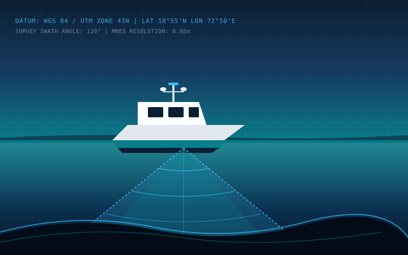
Engineering Rigour Applied to Marine Surveying
Ocean Shore Survey provides specialized hydrographic and marine geophysical surveying services across India. We focus on capturing exact spatial data in complex littoral, nearshore, and offshore environments.
From dredging volume calculations in commercial ports to submarine cable route clearances and structural scour assessments, our technical teams ensure measurements meet the stringent specifications required by marine civil engineers and port authorities.
Comprehensive Marine & Offshore Survey Solutions
Accurate hydrographic measurements, geophysical seabed characterization, and positioning support calibrated to project specifications.
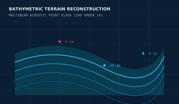
Hydrographic & Bathymetric Surveying
High-precision seabed depth mapping and bathymetric profiling for navigation channels, ports, and waterways.
- ✓Bathymetric contours and color-coded depth models (DEM/DTM)
- ✓XYZ point clouds and gridded depth matrices
Topographic & Drone Survey
High-precision terrestrial topography, UAV aerial LiDAR, and drone photogrammetry for coastal, port, and intertidal zones.
- ✓High-resolution georeferenced aerial orthomosaics (GeoTIFF)
- ✓Digital Surface Models (DSM) and Digital Terrain Models (DTM)
Geophysical & Seabed Investigation
Acoustic seabed imagery, sub-bottom profiling, and hazard detection for coastal and offshore developments.
- ✓Georeferenced acoustic sonar mosaics
- ✓Subsurface stratigraphic profile cross-sections
Offshore Positioning & Navigation
High-accuracy surface and subsea positioning for construction barges, pipelay, and marine assets.
- ✓As-laid position coordinates and real-time positioning logs
- ✓Anchor clearance and approach charts
Oceanographic & Coastal Monitoring
Metocean data acquisition, tidal observation, current metering, and shoreline erosion monitoring.
- ✓Long-term current velocity vector diagrams and harmonic analyses
- ✓Tidal datum verification and harmonic constituent tables
Marine Inspection & Asset Surveys
Acoustic inspection and structural integrity assessment of jetties, berths, seawalls, and underwater pipelines.
- ✓3D point clouds of underwater structures and foundations
- ✓Scour depth volumetric evaluation charts
Marine Sectors We Support
Delivering verified acoustic and spatial survey intelligence across major maritime commercial industries.
Ports & Harbour Authorities
Regular bathymetric charting, channel maintenance depth validation, berth clearance, and harbour development surveys.
Dredging & Marine Contractors
Pre-dredge, interim progress, and post-dredge verification surveys with accurate volumetric cut/fill computations.
Coastal Engineering & Marine Works
Topographic and bathymetric baseline data for breakwaters, jetties, intake/outfall pipes, and shoreline protection structures.
Offshore Energy & Utilities
Seafloor geohazard assessments, subsea cable/pipeline corridor surveys, and offshore platform positioning support.
Shipping & Vessel Operations
Navigational clearance confirmation, under-keel safety assessments, and wreck/obstruction location surveys.
Engineering Consultants & EPCs
Geotechnical and geophysical survey data integration for marine feasibility studies and detailed engineering designs.
Field Acquisition & Processing Rigour
How our survey teams maintain measurement integrity from mobilization to deliverable sign-off.
Acoustic Calibration
Field SVP (Sound Velocity Profiling) casts taken at defined intervals to correct for thermocline and salinity refraction in sounding depths.
Geodetic Control
Tying all survey observations into national reference ellipsoids (WGS 84, Everest 1830) and local Chart Datum / Mean Sea Level (MSL) benchmark stations.
Motion Compensation
Inertial measurement units (IMU) capturing real-time heave, roll, pitch, and yaw dynamics to cancel out vessel movements caused by wave action.
Cleaned Data Models
Filtering flyer soundings, noise artifacts, and multipath reflections using industry-standard hydrographic processing packages.
Industry-Standard Acquisition & Navigation Software
Hypack & Hysweep
ACTIVEPremier hydrographic survey software used for survey design, vessel navigation, single beam and multibeam echo sounder data acquisition, point cloud editing, and dredging volume calculations.
✓ Real-time Hysweep multibeam sensor integration & motion correction
Qinsy
ACTIVEIndustry-standard multi-sensor marine navigation and positioning package delivering real-time data collection, subsea sensor integration, and precise vessel guidance.
✓ Real-time 3D point cloud visualization and quality control
Our Operational Survey Workflow
A transparent, documented 4-step survey delivery workflow designed for EPC contractors and port authorities.
Operational Reach Along Indian Coastlines
Rapid mobilization across all major ports, minor harbours, river navigation channels, and offshore concession zones in India.
Western Seaboard
ARABIAN SEA CORRIDORFull hydrographic coverage across commercial ports, tidal creeks, and offshore energy infrastructure.
Eastern Seaboard
BAY OF BENGAL CORRIDORRiverine navigation channels, post-monsoon siltation monitoring, and deep-draft port approaches.
Rapid Mobilization
PORTABLE SURVEY SPREADSModular sonar, motion sensor, and DGNSS kits mountable on vessels of opportunity or dedicated hydrographic launches.
Frequently Asked Questions
Common technical questions regarding marine survey execution, specifications, and deliverables.
Discuss Your Next Survey Project
Share your project coordinates, depth parameters, and target timeline with our technical surveying desk. We prepare customized proposals with clearly defined survey methodology, equipment lists, and quality assurance procedures.
Request a Survey Quotation
Provide your project coordinates, expected survey type, and schedule requirements.
VITE_ENQUIRY_ENDPOINT.